Overview
Airvoice has implemented a network of 24 air quality monitors in one of Northeast Asia’s most polluted cities. This initiative empowers local researchers and the public by providing reliable data to track pollution trends.
Facts and Numbers
Area: Major city in Northeast Asia
Monitoring Network: 24 stations
Project Duration: Ongoing with over three years of data collection
Technology: Monitors equipped to measure PM2.5, PM10, temperature, humidity, and atmospheric pressure
Challenge
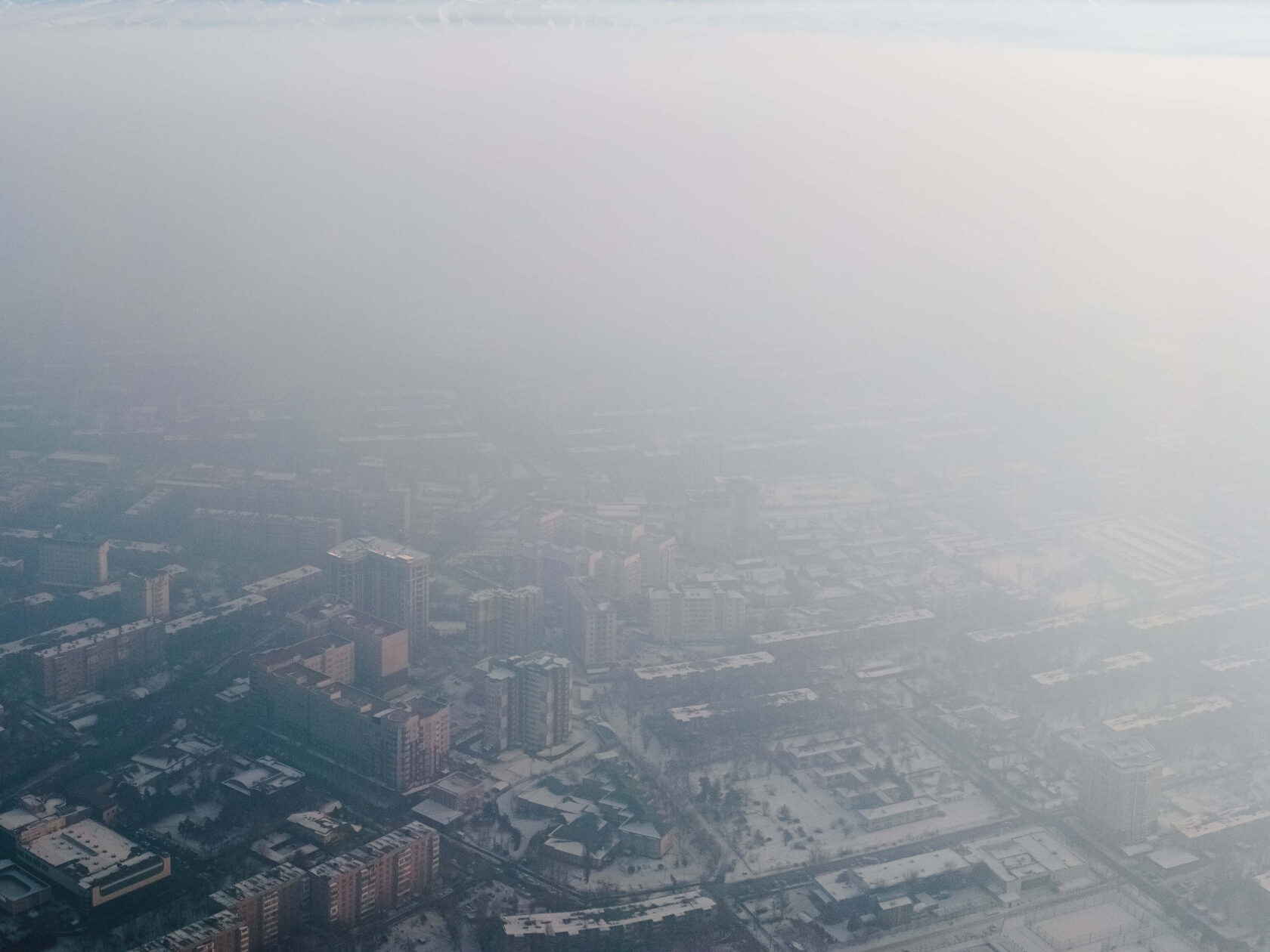
The city, nestled between hills and a major river, and heavily reliant on coal-fired power stations, faces severe air quality challenges. The topography and heating methods contribute to severe pollution episodes exacerbated by the dense residential areas and industrial activities. Periods known as "black sky" days can last up to 20 consecutive days. All this made a comprehensive monitoring system essential for understanding air quality patterns and mitigating pollution.
Solution
To address these challenges, Airvoice deployed a high-density network of compact, cost-efficient monitors designed to withstand extreme conditions, including winter temperatures as low as -50°C. These monitors are strategically placed, including near weather stations for continuous calibration, which ensures data accuracy. This setup extends coverage to previously unmonitored areas, such as remote localities and near major industrial sites, significantly enhancing the city’s monitoring capacity.
Calibration and Mapping
Key calibration is performed at two of the 24 monitoring stations located adjacent to professional weather stations, aligning with regional environmental management standards. This ensures the network's measurements are both accurate and credible.
Results and Impact
The comprehensive monitoring network has provided significant insights into air pollution dynamics, including:
These data have enabled local authorities to make informed decisions, improving public health responses and effectively managing environmental risks.
- Patterns of pollution during anticyclonic conditions.
- The distribution of smoke plumes from forest fires.
- Variations in PM2.5 concentrations due to the city’s landscape and proximity to the unfrozen river, affecting pollution dispersion across districts.
These data have enabled local authorities to make informed decisions, improving public health responses and effectively managing environmental risks.
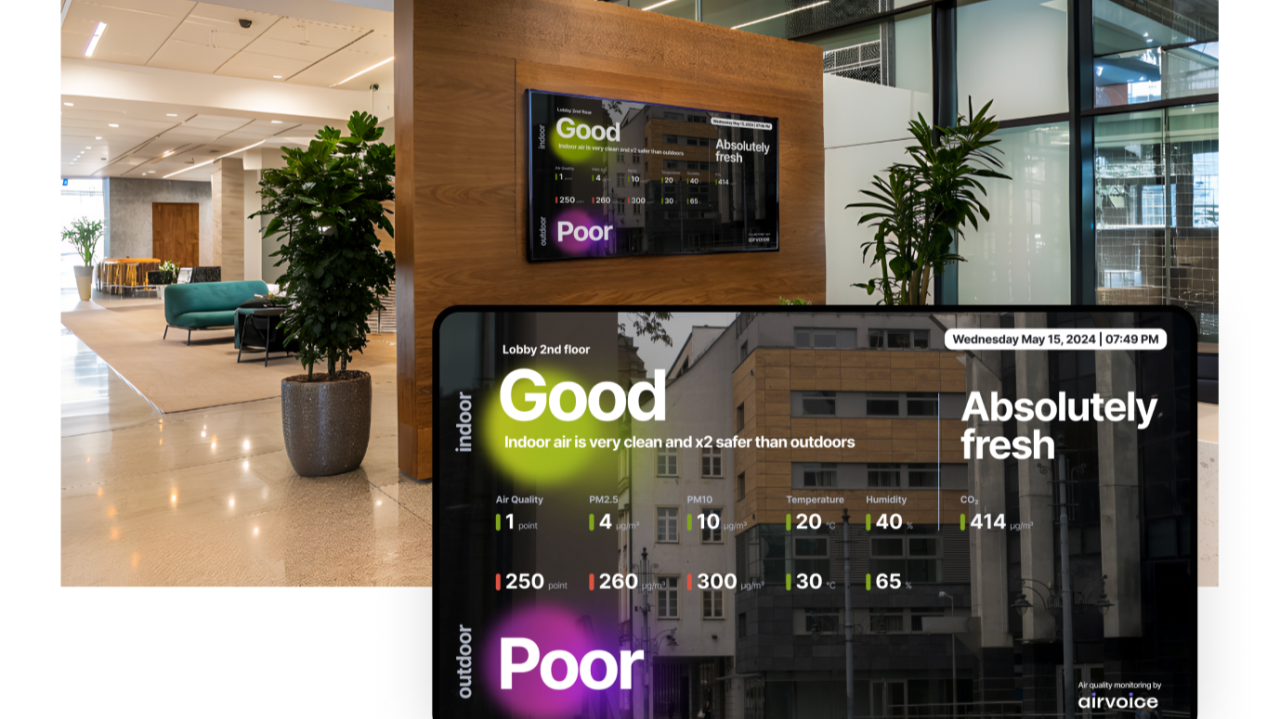
Due to a non-disclosure agreement, the screenshots are from a different location and are used here for illustrative purposes only.
Related Products
Airvoice Ambient Air Quality Monitoring Platform — a software system that consolidates air quality data from sensors and models into a single, user-friendly interface. It offers real-time and historical data analysis, sensor network management, configurable alerts, and report generation, enabling city authorities and industrial managers to respond effectively to incidents, analyze trends, and incorporate air quality data into operational and strategic planning.
Learn more>
Airvoice Ambient Air Quality Monitoring System — an air quality monitor that combines high measurement accuracy with compact, cost-effective design for scalable networks. The system measures PM2.5, PM10, temperature, humidity, and atmospheric pressure, with gas sensors integrated through the Airvoice Hub to track H₂S, CO, NO₂, O₃, SO₂, and other gases as needed.
Learn more>
Learn more>
Airvoice Ambient Air Quality Monitoring System — an air quality monitor that combines high measurement accuracy with compact, cost-effective design for scalable networks. The system measures PM2.5, PM10, temperature, humidity, and atmospheric pressure, with gas sensors integrated through the Airvoice Hub to track H₂S, CO, NO₂, O₃, SO₂, and other gases as needed.
Learn more>
If you’d like to keep up with our latest case studies, product launches, and air quality insights, subscribe to our Newsletter. It arrives no more than once every two weeks.